This interactive map of NYC defines neighborhood borders once and for all
Every true New Yorker knows that nothing sparks a debate faster than asking where one neighborhood ends and another begins. Is Chelsea’s border on 14th Street or 23rd? Does Greenwich Village start at Bleecker or Houston? And is that corner of Mott and Hester officially Little Italy — or Chinatown?
Well, one online map is here to end (most of) those arguments once and for all.
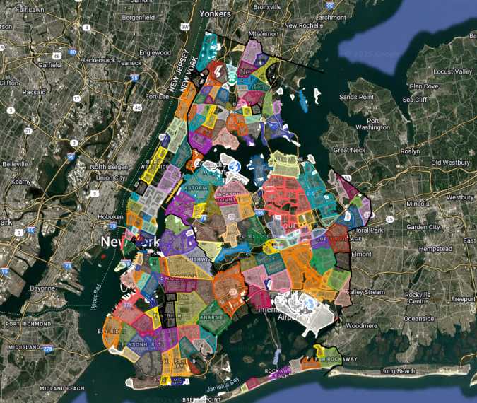
A group of Reddit users has put together a detailed Google Map outlining 282 neighborhoods across all five boroughs — from Red Hook and SoHo to Astoria and beyond. Each area is neatly defined by its borders, making it easy to settle any friendly cross-street disputes.
So, next time you’re wondering, “What neighborhood am I actually in?” you can pull up this interactive guide and get your answer instantly. Sure, New Yorkers will probably still find something to disagree about (it’s part of the city’s charm), but this map gives us all a solid reference point.
If you’re checking out the trendiest neighborhoods of 2025, the map might also come in handy — especially if you’re scouting new places to live or working with a realtor.
And if you’ve already made peace with the Little Italy vs. Chinatown question, there are plenty of other clever maps every New Yorker should bookmark — the kind that make city life a little easier (and a lot more interesting).

