Powerful storm smashes California as multiple flood threats and tornado warnings triggered
San Francisco broke a daily rainfall record Wednesday that had stood since 1917. Water flooded city streets, traffic backed up, and some Waymo self-driving cars stalled. Farther south, forecasters expected Los Angeles County to see its heaviest rain Thursday morning, with communities below recent wildfire burn areas facing the added danger of mud and rocks washing downhill.
The Los Angeles County Fire Department issued evacuation warnings for communities near the Palisades, Hurst and Sunset fire burn areas. A flood watch covered nearly all of the county through Thursday afternoon, except the Antelope Valley.
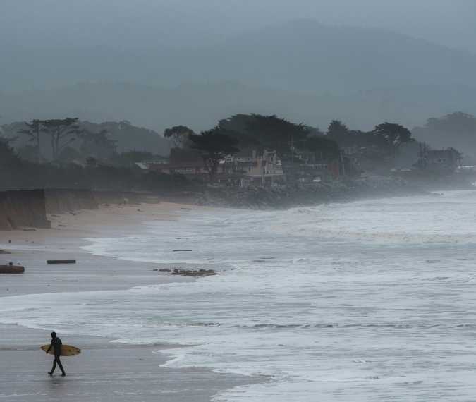
The National Weather Service forecast 1 to 3 inches of rain across Southern California, with up to 5 inches on some coastal slopes. Part of the danger was how quickly that rain could fall. Forecasters said some places could receive three-quarters of an inch in half an hour, enough to flood low-lying streets and send water surging through creeks and canyons. Conditions in the Los Angeles Basin could also support isolated weak tornadoes, while storm-driven waves continued to pound the coast.
Rain gives way to snow at higher elevations.
As the storm moved inland, even much of Southern California’s mountain terrain was expected to see rain at first. Snow levels were forecast to stay above 7,000 feet until colder air arrived near the storm's end. By then, 1 to 3 inches of snow could fall as low as 5,500 feet.
Farther north, the forecast called for substantially more snow. The northern Sierra Nevada and southern Cascades could pick up another 8 to 12 inches above 4,000 feet, with up to 20 inches on the highest peaks. Light snow could reach 3,500 feet.
Wind and high tides add to Northern California’s risks.
More showers and thunderstorms were forecast for San Francisco on Thursday. Inland, forecasters warned that some thunderstorms could become severe across the Sacramento Valley, the Delta and nearby foothills, particularly south of Interstate 80. A wind advisory covered the Sierra Nevada, the foothills and the Delta, with gusts up to 55 mph. In low-lying parts of the Delta, high tides could worsen flooding.
Forecasters expected the storm to weaken Thursday night, though Sierra showers could linger into Friday morning. Southern California was expected to see brighter skies Friday and modest warming Saturday. In the north, the weekend outlook called for possible fog and Saturday morning temperatures in the 30s in the Sacramento Valley, with teens and 20s in mountain communities.