
Hurricane Isaias strengthens to Category 2 storm, evacuations expand across Gulf ahead of dangerous landfall
El Niño-driven wind shear has caused a record-slow start to the Atlantic hurricane season, with Isaias becoming the latest first hurricane to form since the satellite era began in 1966.
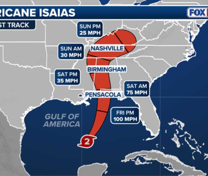
Hurricane Isaias is continuing to strengthen in the Gulf after becoming the first Atlantic hurricane of the season and expected to make landfall along the northern Gulf Coast later this week as a dangerous Category 2 hurricane.
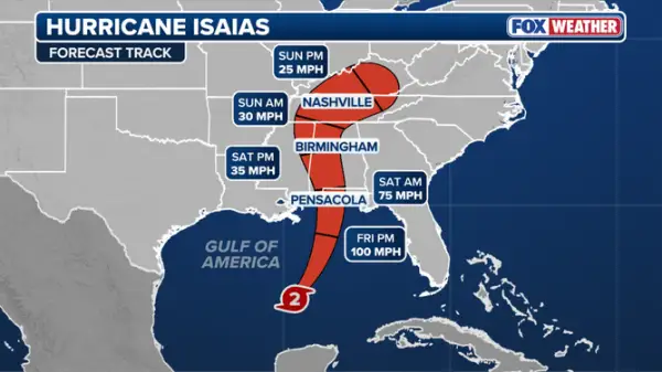
Isaias is expected to approach the coast by Friday, with landfall currently estimated to be sometime late Friday or early Saturday between Gulf Shores, Alabama, and Pensacola, Florida.
Isaias strengthened from a Category 1 to a Category 2 hurricane on Thursday, with sustained winds of 100 mph as it moves northeast at 12 mph.
Florida Gov. Ron DeSantis, Alabama Gov. Kay Ivey and Georgia Gov. Brian Kemp have declared states of emergency ahead of the storm.
In a Thursday press conference, DeSantis urged residents to prepare now, including filling up their gas tanks and stocking up on enough water and nonperishable food to last through a potential power outage.
"If you are in the Panhandle, assume that you are going to lose power," DeSantis said. "Prepare to lose power. That is likely to happen with a storm that is at hurricane status."
Over a dozen Florida and Alabama counties have canceled school through the end of the week, and multiple colleges have closed their campuses.
Meanwhile, evacuation orders have been issued for Dauphin Island in Alabama, as well as Okaloosa and Escambia counties in Florida.
The City of Orange Beach has issued mandatory evacuations of coastal tourists and visitors.
"In anticipation of the expected impacts from Tropical Storm Isaias, the cities of Gulf Shores and Orange Beach are encouraging all non‑residents, and residents living in low-lying, flood prone areas to voluntarily evacuate," a statement from city officials said. "City officials urge all individuals who are not permanent residents to leave the area immediately and relocate to a safer location."
Both Shell and Chevron have instituted shut-in production procedures across five of their offshore oil facilities in the Gulf and removed non-essential workers, respectively.
BP said it was also removing non-essential personnel and securing offshore facilities. ExxonMobil operations are currently normal, but they are monitoring the forecast closely.
Hurricane Isaias strengthened from Tropical Storm Isaias late Wednesday night.
In their Wednesday 11 p.m. update, the National Hurricane Center kept Isaias at tropical storm strength. About 30 minutes later, they released a special advisory stating that Isaias had indeed strengthened into a Category 1 hurricane.
Isaias rapidly intensified from a tropical storm into a Category 1 hurricane, with winds increasing by 40 mph in just 6 hours between Wednesday afternoon and late Wednesday night.
Isaias' forecast cone shows it heading directly toward the northern Gulf Coast, with impacts centered over roughly 30 million people in Louisiana, Alabama, Mississippi and the Florida Panhandle.
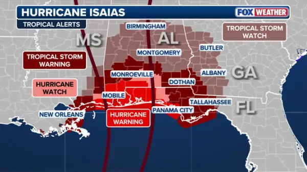
Tropical weather advisories have expanded inland, across parts of southern Alabama and southwestern Georgia.
A Hurricane Warning is in effect from Ocean Springs, Mississippi, to the Bay/Gulf County Line in Florida.
A Storm Surge Warning is also in effect from the mouth of the Mississippi to the Suwannee River in Florida's Big Bend region.
"The combination of a dangerous storm surge and the tide will cause normally dry areas near the coast to be flooded by rising waters moving inland from the shoreline," the NHC said.
Currently, between 5 and 7 feet of surge is forecast for Mobile Bay and from Ocean Springs, Mississippi, to Indian Pass, Florida.
Heavy rain is expected to begin on Friday, with flash flooding, damaging wind gusts, storm surge and even tornadoes possible as the storm comes ashore.
Read More : foxweather.com

