Terrifying new images show Super El Nino developing into 'strongest weather event for 1,000 years'
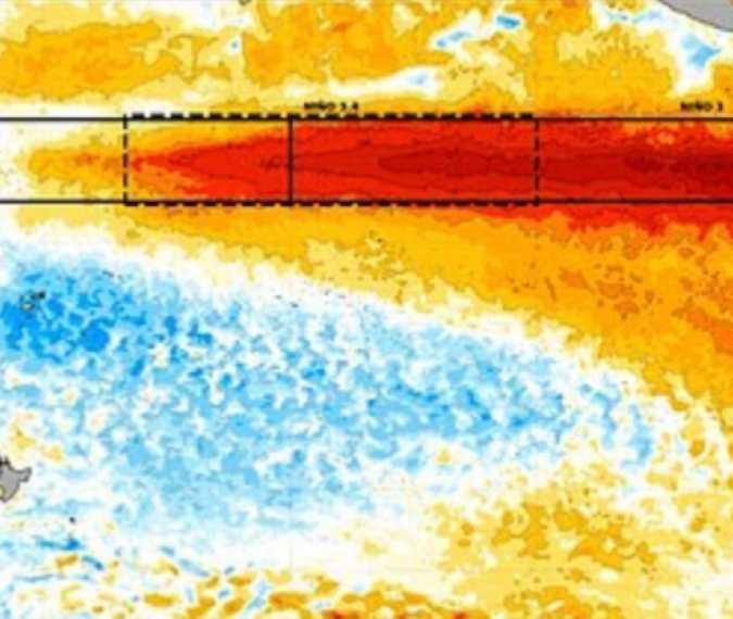
An exceptionally strong El Niño is developing in the Pacific, and forecasters warn it could reshape rainfall patterns and increase weather risks worldwide into early 2027.
The World Meteorological Organization’s October update forecasts further strengthening before a possible December peak. It puts the likelihood of El Niño continuing through February 2027 at close to 100%, with unusually high temperatures in the central and eastern tropical Pacific expected during the final months of this year.
El Niño is the warm phase of a recurring ocean–atmosphere cycle. As the tropical Pacific warms and atmospheric circulation changes, the effects can spread far beyond the ocean itself, influencing temperatures and rainfall across different continents.
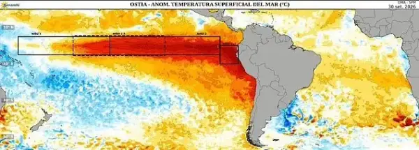 (Senhami)
One particularly striking assessment comes from climate scientist Zeke Hausfather. Writing in The Climate Brink, he argues that the 2026 event could become the strongest El Niño in roughly a millennium if forecasts of its eventual peak hold up.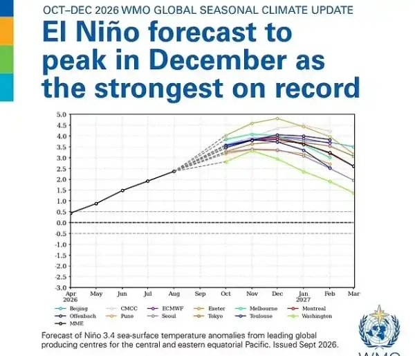
(WMO)
His analysis compares modern observations and forecasts with evidence from tree rings and corals. These natural records help researchers estimate conditions before widespread thermometer measurements, although they contain gaps and uncertainties. The millennium-scale comparison therefore remains an assessment with important qualifications, rather than a confirmed historical ranking. It also concerns El Niño’s strength—not whether this is the most powerful weather event of any kind in 1,000 years.
The consequences will vary considerably by location. WMO forecasts point to a higher chance of wetter conditions in regions including the Greater Horn of Africa and southeastern South America. Meanwhile, parts of Central America, the Caribbean and northwestern South America face a greater likelihood of reduced rainfall. These shifts can increase pressure on water supplies, agriculture and communities exposed to flooding or drought.
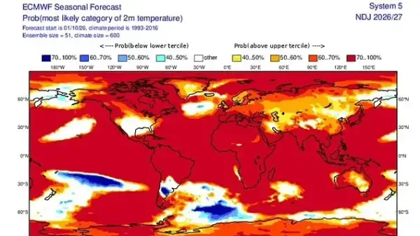
(ECMWF)
For Britain, the outlook is more complex than a simple prediction of warmer weather. The Met Office expects El Niño to increase the chances of wetter and stormier conditions across northwestern Europe during autumn and early winter. Its guidance also stresses that competing climate drivers influence how El Niño’s effects reach the UK.
Seasonal forecasts describe changing probabilities across broad regions. They cannot determine the weather on a particular day or replace local forecasts. As the Pacific continues to evolve, updated observations will help establish how strong this El Niño ultimately becomes and where its effects are most likely to be felt.